Working in the Bunkhouse
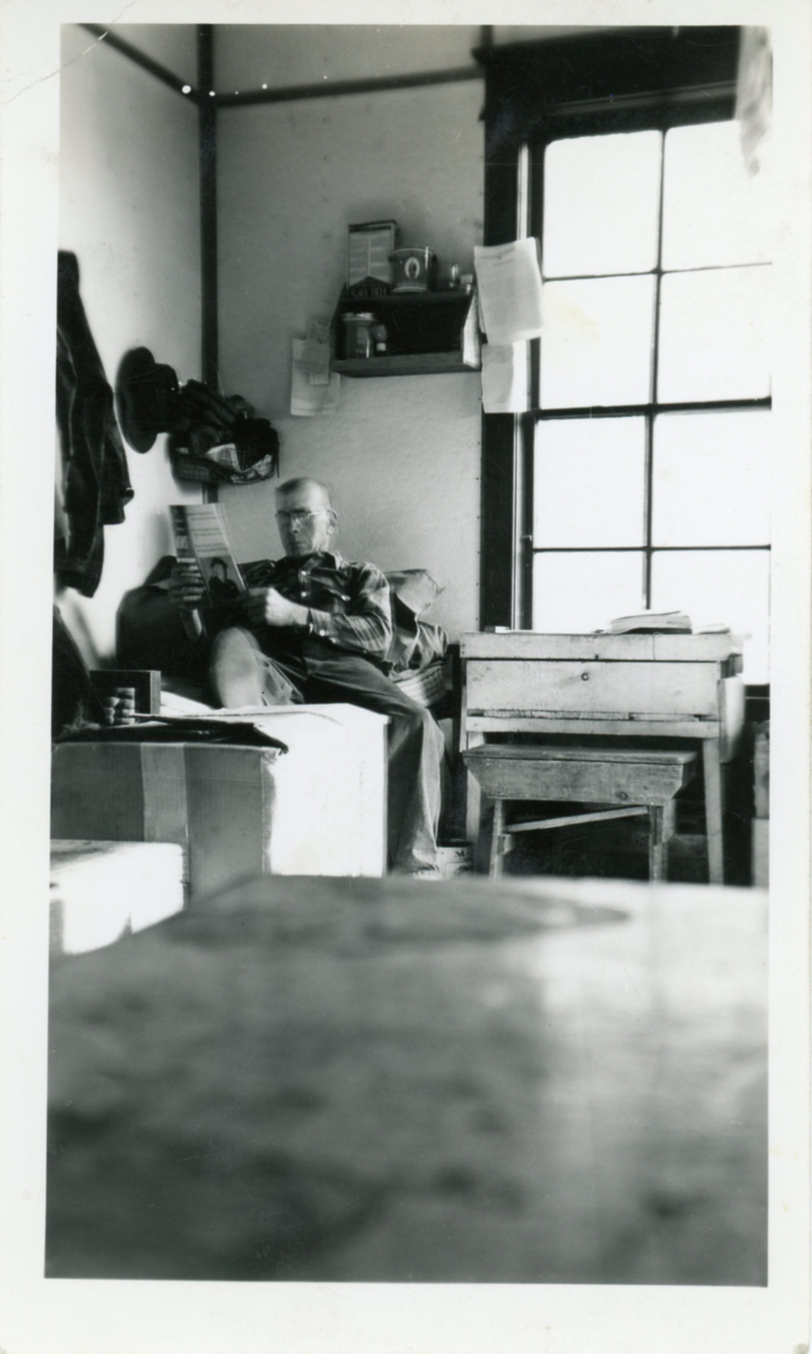
Print Photograph, 2 3/4 in. x 4 1/2 in.
Attached Note: Handwritten inscription in ink, "Katie's father after working, resting in the bunkhouse at Moose Creek, which later became her Aunt Mary's house. It is now at the Sutton Museum [Alpine Historical Park]."
Beginning in 1898, survey crews from the United States Geological Survey identified and mapped coal fields in the Matanuska Valley along Moose Creek, Chickaloon River, and the Matanuska River (Irwin 2). The coal fields, which still exist today, cover approximately 200 square miles with the Matanuska River, which runs approximately for 80 miles, passing through it for half its distance. Within the area of the coal deposits lies several tributaries, primarily entering the Matanuska River from the north. Among them are: Chickaloon River, Kings River, and Hick’s, Gravel, Monument, Coal, Carbon, Granite, Young, Eska and Moose Creeks. The region is scenic with a valley that averages six miles wide surrounded by the peaks of the Chugach Range to the south, the Talkeetna Range to the east and the Alaska Range to the north. The lower areas of the ranges are filled with rolling hills covered in forests (Bauer, 5).
Early surveys divided the Matanuska coal bed into three main fields: Chickaloon, Eska-Moose, and Young Creek. The Chickaloon field is in the lower part of the valley of Chickaloon River. It extends as far west as the Kings River, south across the Matanuska River into the valley of Coal Creek. The Eska-Moose field extends from the valley of Eska Creek to the west as far as Moose Creek. The Young Creek field lays between the Chickaloon and Eska-Moose fields, situated in the upper part of the valley of Young Creek. The coal beds found in these fields are of the Tertiary age. They are comprised of three kinds of coal: anthracite, high-grade bituminous and low-grade bituminous (Bauer, A History of Coal Mining, 6-7). This wide variety of coal would allow for multiple mining operations to emerge and operate simultaneously without fear of encroaching on each other’s profit potential since each type of coal served a different market.
Bauer, Mary Cracraft. The Glenn Highway: The Story of its Past, A Guide to its Present. Sutton: Brentwood Press, 1987. Print
Bauer, Mary Cracraft and Victoria A. Cole. A History of Coal-Mining in the Sutton-Chickaloon Area Prior to WWII. Anchorage: Alaska Historical Commission, 1985. Print.
The Matanuska watershed holds deep cultural significance for the Ahtna Dene. Once a rich and vibrant region, it provided an abundance of salmon, moose, and sheep, and served as a gathering place where the Ahtna met and traded with the Dena'ina. Elder Alberta Stephan recalled that the ancestral trail system near the Chickaloon River was so heavily used by Ahtna travelers that it became worn three feet deep into the earth.
The 1913 Nelchina gold rush brought a surge of non-Native travelers through the Matanuska Valley and led to the expansion of the ancestral Nay’dini’aa Na’ Kayax trail. In 1917, the federal government funded the construction of a railroad that followed this trail system, running parallel to the Matanuska River for approximately forty miles. Along with the railroad came stations, spurs, federally supported coal mines, and new settlements—all of which contributed to the widespread loss of irreplaceable cultural resources, sacred sites, and traditional knowledge.
By 1925, at least two Tribal village sites and many miles of the Nay’dini’aa Na’ Kayax ancestral trail had been destroyed, along with several salmon spawning grounds critical to Ahtna subsistence. Though much of the railroad in the Matanuska watershed was eventually abandoned by 1930, the damage to Ahtna cultural landscapes remains.
Family Genealogy:
Leland (Lee) Harrison was the second husband of Annie Nikolai.


Attribution-NonCommercial-NoDerivatives 4.0 International (CC BY-NC-ND 4.0)