Before the Rock Garden
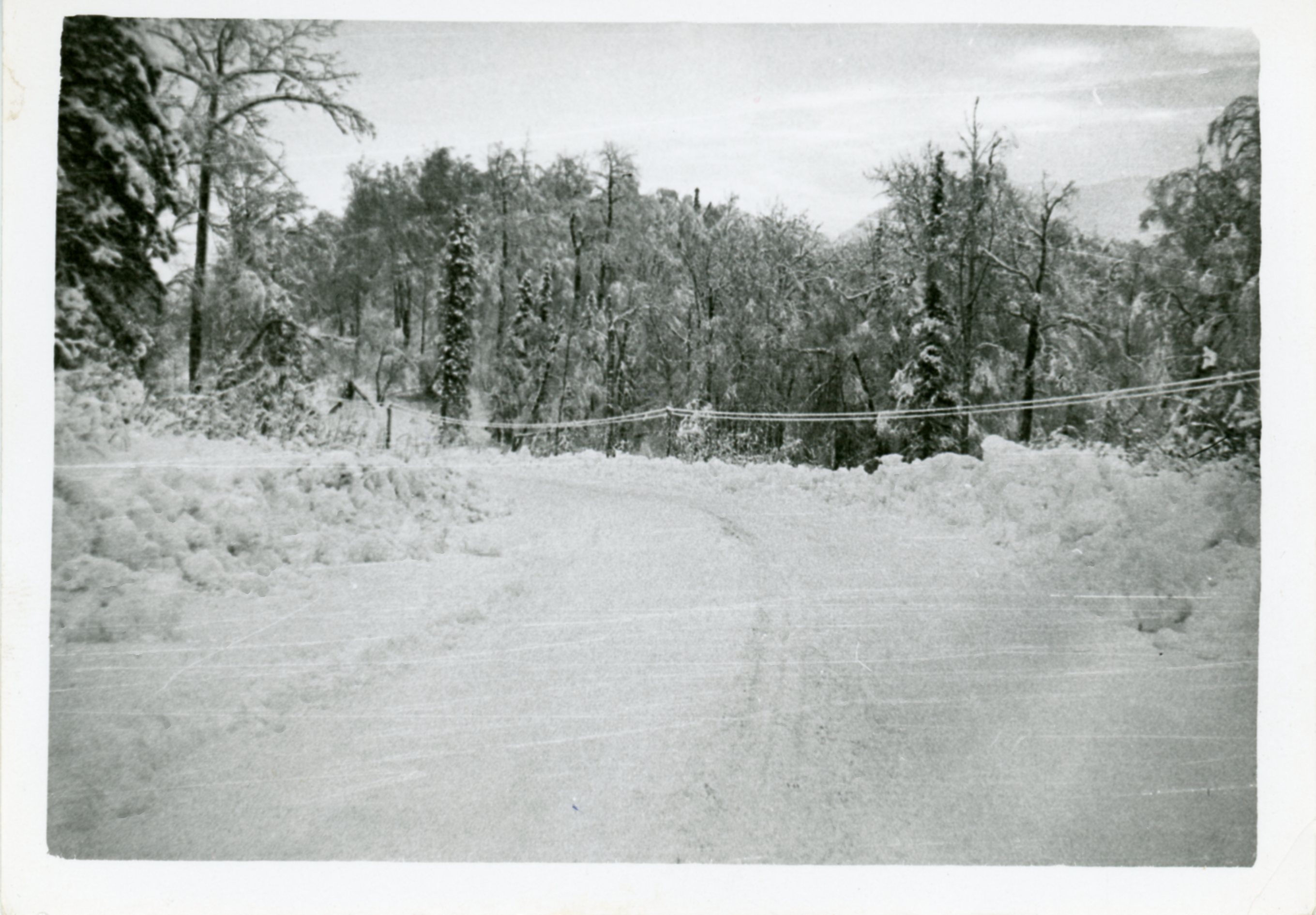
Print Photograph, 4 1/2 in. x 3 1/4 in.
Reverse of Print: Handwritten inscription in ink, "Highway our front before it was paved, and before we moved here." Attached to print: Handwritten inscription in ink, "Before the rock garden looking up the road."
The photograph shows the site of the current CVTC Administrative Campus and the Ya Ne Dah Ah Dats'ehwdeldiixden (School) before the land was cleared. This location was also the former home of Katherine and "Tiny" Wade located near Moose Creek.
With the advent of automobiles and trucks, better roads and eventually highways, became a necessity. In the late 1800’s, several expeditions were led into interior Alaska in an effort to discover the most direct and practical route from the Cook Inlet. Most notably, was the expedition commanded by Captain Edwin Forbes Glenn and scouted by Lieutenant Joseph C. Castner from the Cook Inlet to Circle City. With the development of the Matanuska Colony and the onslaught of World War II military bases in Anchorage, Fort Richardson and Elmendorf, there was a need to finally create a road that connected them all. In 1941, the Alaska Road Commission received a one-million-dollar appropriation from Congress, endorsed by the War Department, to construct the Glenn Highway. Glenn and Castner’s original trail, along with others leading to the Matanuska coal fields, served as the general route in which the highway followed. The road was constructed from both ends with crews working from Anchorage in Southcentral Alaska and from Glennallen, 135 miles northeast where the Richardson Highway began. For four years, as many as 600 men worked to build the twenty-foot-wide road. During the long summer days, they worked around the clock in three different shifts and in the winter, the bridge crews worked, building footings and spans while the water was low or frozen (for easier accessibility). Between Sutton and the railroad bridge over the Chickaloon River they used the old railroad bed, tearing up the old ties and laying down the road. With the Eska and Chickaloon Mine closures, the train had stopped running years before in 1933 and the tracks had been torn up (Bauer The Glenn Highway 7-9). The highway was completed in 1945. The completion of the Glenn Highway and the simultaneous completion of the Tok cutoff and the Alcan (trans-Canadian highway) opened up Alaska as it was finally connected to the lower United States. The end of the war subsequently opened the road to all traffic which inspired the additional development of lodges and services (Bauer, 10-11).
The Glenn Highway was the final key to opening the Matanuska Valley to the arrival of new settler outsiders and visitors. To this day, it serves as the main route into southcentral Alaska. For the Dene, it meant that they had been pushed further out of their ancestral homelands. They were forced to watch as their ancestral homelands became private property to colonists and other settler outsiders, divided and sold repeatedly. These new development projects and settlements were invasive to the wildlife population of the region. What was once bountiful land could barely provide enough to sustain the Dene population anymore. Today, seasonal hunting must be done much farther north than in the past.
Bauer, Mary Cracraft. "The Glenn Highway: The Story of its Past, A Guide to its Present." Sutton: Brentwood Press, 1987. Print


Attribution-NonCommercial-NoDerivatives 4.0 International (CC BY-NC-ND 4.0)