
Montana Creek Bridge, mile 210
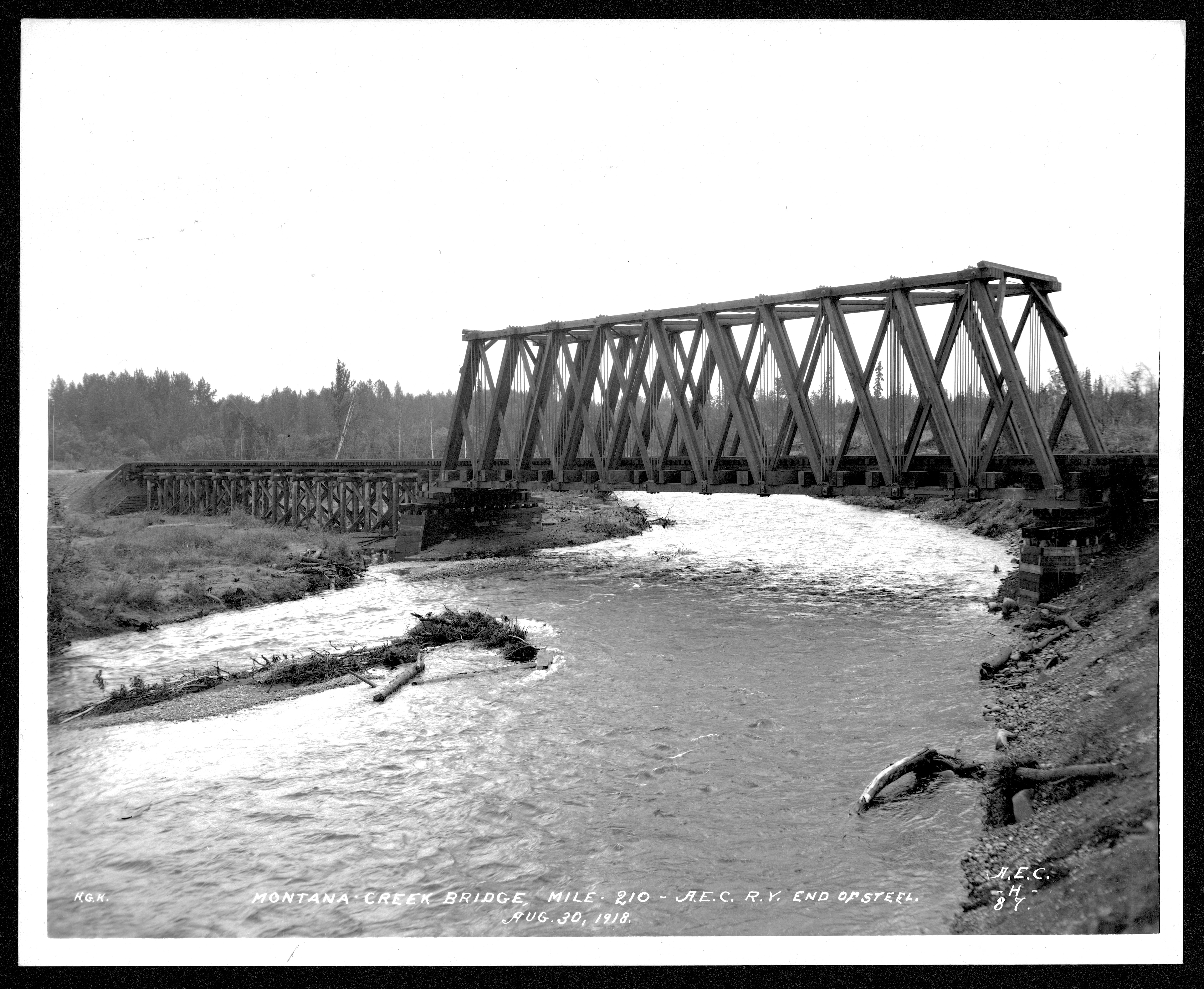
Print Photograph;[Possibly H.G. Kaiser photo]. Front reads: H.G.K. Montana Creek bridge, mile 210 - A.E.C. R[ailwa]y. End of steel. Aug. 30, 1918. A.E.C -H- 87.


Attribution-NonCommercial-NoDerivatives 4.0 International (CC BY-NC-ND 4.0)
Print Photograph; [Possibly H.G. Kaiser photo]. Front reads: H.G.K. Montana Creek bridge, mile 210 - A.E.C. R[ailwa]y. End of steel. Aug. 30, 1918. A.E.C. -H- 87.
The development of the Alaska Railroad brought significant and lasting changes to the traditional homelands of the Ahtna and Dena'ina people. While often described as a project intended to connect communities across the state, its construction followed routes long established by Indigenous travel and trade networks, transforming these pathways into corridors of industrial expansion.
The railroad introduced an influx of non-Native populations and large-scale development that altered the land in profound ways. Areas that had sustained Ahtna and Dena'ina subsistence lifeways for generations experienced environmental disruption, including land disturbance, pollution, and, in some places, the diversion of waterways that affected salmon populations—an essential source of food, culture, and continuity for the community.
These changes impacted not only the physical landscape but also the relationships between people, land, and resources that have long guided Ahtna ways of life. Despite these disruptions, Ahtna and Dena'ina people have continued to adapt, maintain cultural practices, and uphold responsibilities to their homelands.
Today, the work of Chickaloon Village Traditional Council’s Environmental Stewardship Department reflects these enduring relationships. Their efforts focus on protecting and restoring the land and waters, addressing the impacts of past development, and ensuring that future generations can continue to live in connection with their ancestral lands.
* The Upper Inlet Denaʼina Athabascan name for Montana Creek is Qiduk'ggat.
This material depicts an Alaska Engineering Commission (AEC) bridge located in the Cantwell–Curry region, within the traditional homelands of the Ahtna Athabascan people and neighboring Dene communities. While the image documents a moment in mid-20th century industrial and federal presence, it also reflects a longer history of outside development in this region tied to the Alaska Railroad corridor.
For Ahtna people, this area is not an isolated “site,” but part of a living cultural landscape shaped by generations of travel, seasonal movement, subsistence practices, and kinship connections. Trails that later informed railroad routes were originally Indigenous pathways connecting communities, hunting grounds, and fishing areas. The construction of the railroad and subsequent federal projects, including AEC activities, brought significant changes to these relationships with the land.
These developments introduced wage labor economies, increased non-Native settlement, and imposed new forms of land access and control that disrupted traditional lifeways. They also contributed to environmental changes that affected wildlife patterns and subsistence resources. At the same time, Ahtna people adapted in multiple ways—engaging with new economic opportunities while continuing to maintain cultural practices, knowledge transmission, and stewardship responsibilities.
This image should be understood not only as documentation of infrastructure or government activity, but as part of a broader history of Indigenous resilience and continuity in the face of ongoing colonial and industrial pressures. Community knowledge emphasizes that these lands remain culturally significant, and relationships to them continue into the present.
Note: Place names, interpretations, and contextual information in this record may be expanded or refined through consultation with Ahtna Elders and Culture Bearers. Many Ahtna and Dena’ina ancestors contributed labor to the construction of railroad infrastructure projects, specifically the building of bridges such as the one depicted in this photograph.


Attribution-NonCommercial-NoDerivatives 4.0 International (CC BY-NC-ND 4.0)